
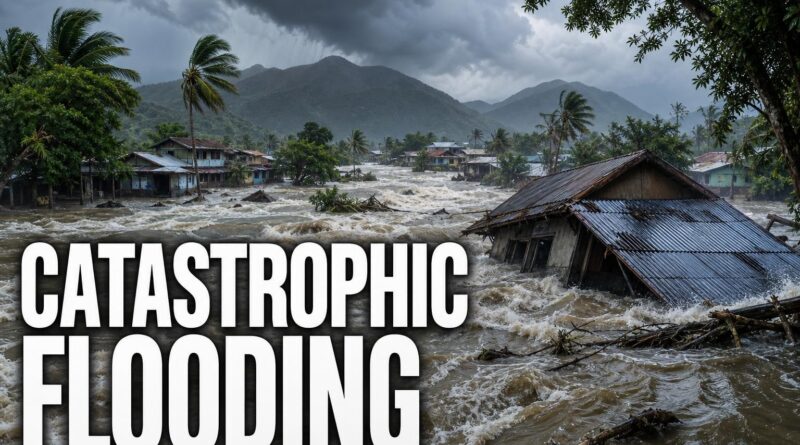
El Niño Forecast: What Scientists Fear Most
El Niño Forecast: What Scientists Fear Most
There is a moment, deep beneath the surface of the Pacific Ocean, when something enormous shifts. The winds slow. The warm water that had been pushed westward for months begins sliding back east. And with that slow, silent reversal, weather systems across the entire planet start to reorganise — monsoons weaken, droughts ignite, coral reefs bleach, and wildlife populations that have no warning system and no evacuation plan begin to collapse.
That phenomenon is El Niño. And right now, forecasters are watching a new event build across the Pacific — one that, by multiple accounts, is shaping up to be among the more significant in recent memory. To understand why that matters, you have to understand what El Niño actually does to the living world, and why its consequences are almost always underreported until it’s too late.
What El Niño Actually Is — And Why “Weird Weather” Doesn’t Cover It
Most people hear “El Niño” and think: hotter summers, strange rainfall. That’s accurate the way “a big wave” is accurate for a tsunami — technically true, completely insufficient.
El Niño is not a storm or a season. It is a fundamental shift in the Pacific Ocean’s behaviour. Under normal conditions, powerful trade winds push warm surface water westward, piling it up near Australia and Indonesia. Cold, nutrient-rich water rises from the deep along South America’s coast to replace it. Then, periodically, those trade winds weaken. The warm water sloshes back east. The entire temperature pattern of the world’s largest ocean flips.
What follows is what climate scientists call a teleconnection — a chain reaction where one change in one ocean triggers consequences thousands of kilometres away. The Indian monsoon shifts. Droughts ignite in regions that are usually wet. Wildfires spread in forests that are normally damp. Fish populations vanish from coastlines that entire communities depend on.
El Niño is the most powerful teleconnection on Earth. It doesn’t change the weather. It reorganises it.
What a Strong El Niño Looks Like When It Walks Into the World
Numbers on a chart don’t tell the story. What does a powerful El Niño actually look like when it arrives?
The Galápagos Islands offer one of the most vivid historical records. During strong El Niño events, the warm water that defines the event pushes cold, nutrient-rich currents away from the islands’ shores. The fish disappear. Seabirds that depend on those fish to feed their chicks begin to abandon nests. Sea lion populations crash as mothers struggle to find enough food to produce milk. Wildlife populations that took decades to stabilise have historically collapsed within a single season when a strong event arrives.
The marine world takes perhaps the hardest hit overall. Coral reefs are extraordinarily sensitive to water temperature — a sustained rise of even one or two degrees Celsius can trigger mass bleaching events, where corals expel the symbiotic algae living in their tissues and turn ghostly white. Without that algae, the coral slowly starves. Some recover when temperatures drop. Many do not, and the reefs that die take centuries to rebuild, if they rebuild at all.
The disruption doesn’t end when the warm water retreats. It echoes through food chains for years afterward, measured not in temperature anomalies but in generations of animals that never recovered.
The Part Nobody Reports: Wildlife Doesn’t Get a Warning
Here is what separates El Niño from other environmental pressures: it arrives without a press conference for the animals.
Humans receive forecasts. Farmers get advisories. Governments activate drought protocols and emergency water management plans. But the sea turtle nesting on a beach has no way of knowing that shifting ocean temperatures are about to alter sand conditions in ways that affect her eggs. The seabird colony has no bulletin warning that the fish they depend on have moved hundreds of kilometres away. The coral polyp has no evacuation plan.
This is the dimension of El Niño that almost never makes it into the weather forecast. The ocean temperature anomaly gets reported in decimal points. The consequences for living creatures get measured in generations — and often don’t appear in any headline until the population crash is already underway and already, in many cases, irreversible.
Strong El Niño events have historically been followed by years of slow, difficult ecological recovery in affected regions. The warm water retreats. The fish return, gradually. The seabirds attempt to rebuild colonies. But the timeline for biological recovery rarely matches the timeline for the next event — and when events arrive in succession, populations that never fully recovered face the next disruption already weakened.
Why India Watches El Niño More Closely Than Almost Anyone
India sits at a particular intersection of El Niño’s reach. The subcontinent’s summer monsoon — one of the most consequential weather systems on Earth, delivering the rainfall that hundreds of millions of people and countless ecosystems depend on — has historically weakened during strong El Niño events. Less rain means lower rivers, shrinking reservoirs, and stressed groundwater systems.
India’s wildlife is deeply calibrated to the monsoon’s rhythm. The forests of the Western Ghats, the wetlands that migratory birds travel thousands of kilometres to reach, the river systems that support freshwater dolphins and critically endangered gharials — all of these operate on a seasonal schedule that a disrupted monsoon can throw into crisis. When rains fail, watering holes dry up. When watering holes dry up, wildlife from vast areas converges on the few that remain, creating dangerous concentrations, elevated disease pressure, and increased human-wildlife conflict.
But El Niño doesn’t simply remove water. It redistributes it — often to the wrong places at the wrong times. Some regions see flash flooding in areas that are normally dry. The unpredictability is itself a form of damage, because ecosystems and the communities that depend on them are adapted to patterns, not chaos.
Why Today’s Baseline Makes Every El Niño More Dangerous Than the Last
Here is the part that forecasters are increasingly reluctant to leave out of the conversation: El Niño does not operate in isolation. It operates on top of whatever the ocean’s baseline temperature already is — and today’s baseline is warmer than it has been at any point in recorded human history.
That matters because El Niño’s impacts are additive. The event doesn’t set the ocean temperature. It raises it above wherever it already sits. When the starting point is already elevated due to long-term ocean warming, even a moderate El Niño can push temperatures into ranges that would previously have required an exceptional event to reach. Coral bleaching thresholds get crossed more easily. Drought conditions intensify more rapidly. The ecological damage that once required a historically rare event to trigger can now be reached by something far more ordinary.
This is why scientists increasingly frame El Niño not just as a natural cycle but as a natural cycle interacting with a changed planet — one where the floor has risen, and every spike now starts from higher ground.
The ocean is not sending a warning. It is already moving. The trade winds have slowed. The warm water is sliding east. The teleconnections are beginning to fire, one by one, across a planet whose ecosystems — from coral reefs to monsoon forests to seabird colonies — are already operating under pressure they have never faced before. El Niño has arrived before. It will arrive again. But it has never arrived on a planet quite like this one.
Frequently Asked Questions
What is El Niño and how does it affect weather?
El Niño is a fundamental shift in Pacific Ocean behaviour where trade winds weaken and warm water slides back east, triggering a chain reaction that disrupts monsoons, ignites droughts, spreads wildfires, and collapses fish populations thousands of kilometres away.
How does El Niño start in the Pacific Ocean?
El Niño begins when powerful trade winds that normally push warm surface water westward slow down, causing that warm water to slosh back east and flip the entire temperature pattern of the Pacific Ocean.
What is a teleconnection in climate science?
A teleconnection is a chain reaction where one change in one ocean triggers weather consequences thousands of kilometres away, such as El Niño shifting the Indian monsoon or causing droughts in regions that are usually wet.
Recommended Reading
Explore these hand-picked resources to dive deeper into this topic:
- The Water Will Come by Jeff Goodell
- Braiding Sweetgrass by Robin Wall Kimmerer
- National Geographic Globe (interactive learning tool)
As an Amazon Associate, we earn from qualifying purchases. This helps support Fact Storm Hub at no extra cost to you.
Sources
- https://themalaysianreserve.com/2026/07/09/el-nino-likely-strongest-seen-in-75-years-us-forecasters-say/amp/
🤖 AI Content Disclosure
This article was created using AI-assisted research and writing tools, then reviewed for quality and accuracy. Facts are sourced from publicly available web research, but readers should verify critical information from primary sources.
Published for educational and entertainment purposes. Last reviewed: July 2026