
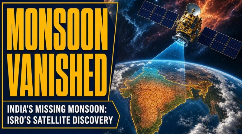
India’s Missing Monsoon: ISRO’s Satellite Discovery
India’s Missing Monsoon: ISRO’s Satellite Discovery
Mumbai is underwater right now. Roads flooded, trains delayed, the city grinding to a halt under sheets of rain. But here’s what the news cameras aren’t showing you — the view from 36,000 kilometres above Earth, where India’s own satellites watched this entire monsoon season unfold in real time, and caught something genuinely strange along the way.
The “Missing Monsoon” That Scared Everyone
Late June 2026. Satellite imagery coming out of ISRO and IMD showed something that made meteorologists stop and look twice.
Almost clear skies over India. Barely a rain cloud in sight.
For a country that runs on the monsoon — its agriculture, its reservoirs, its entire summer economy — this was a quiet alarm going off. The rain deficit at that point had climbed to 45%. Nearly half the expected rainfall for the season, simply absent. The satellite images made it visual in a way that no weather chart could: vast stretches of India, bone dry, sitting under open sky when they should have been soaked.
This is what meteorologists call a monsoon break — a pause in the seasonal system. But seeing it from space, in the water vapour and infrared channels of ISRO’s INSAT-3DR satellite, gave it a different weight entirely. You could see exactly where the moisture had retreated to, and exactly what India was waiting for.
Then the Satellites Watched It Come Back — Fast
By July 3, 2026, the picture had completely flipped.
Fresh imagery from INSAT-3DR and global weather satellites showed a vast cluster of towering rain clouds massing over the east-central Arabian Sea. The cloud tops were registering extremely cold temperatures in the infrared channel — a detail that sounds technical but tells a very specific story. Cold cloud tops mean the storms are reaching high into the atmosphere. That’s deep convection. That’s the atmosphere doing something powerful.
Within days, those clouds were advancing directly toward Maharashtra’s coast.
What the satellite imagery also revealed — and this is the part worth pausing on — was that this wasn’t a single system. ISRO’s images showed two separate, powerful monsoon systems driving intense rainfall simultaneously: one over Maharashtra, one over West Bengal, on opposite sides of the country. Two engines running at the same time.
The result? Dense cloud bands stretched across western India. The rain deficit, which had sat at 45% just weeks earlier, dropped to 28%. A 17-percentage-point swing in a matter of days. That’s not a gradual recovery — that’s the monsoon arriving with something to prove.
What ISRO Is Actually Seeing Up There
Most people think of weather satellites as cameras. Point them at clouds, get a picture. The reality is considerably more layered.
IMD’s satellite portal — mausam.imd.gov.in — offers meteorologists multiple ways to read the same scene. Infrared imagery reads heat signatures, revealing cloud-top temperatures that indicate storm intensity. The visible channel works like a standard photograph, showing cloud structure. The water vapour channel tracks moisture in the atmosphere even where no clouds exist yet — essentially letting forecasters see where the next storm is being built before it forms. Cloud Top Brightness Temperature imagery gives precise data on how high and how energetic a storm system is.
INSAT-3DR, ISRO’s dedicated meteorological satellite, feeds all of this continuously. It’s not taking snapshots — it’s watching in near real time, updating imagery every 30 minutes. When that cloud mass was moving toward Maharashtra on July 3, forecasters weren’t guessing. They were watching it move, frame by frame, from space.
This is the part of India’s space programme that rarely gets the headline — not the Mars mission, not the lunar landing, but the unglamorous, essential work of watching the sky so 1.4 billion people can plan their lives around the rain.
Why This Matters More Than a Weather Update
India’s monsoon isn’t just a weather event. It’s the backbone of the country’s food supply. A 45% rain deficit in late June isn’t an inconvenience — it’s a potential agricultural crisis in slow motion.
The speed at which satellite data can now track monsoon recovery changes how India responds. When the imagery showed those Arabian Sea clouds building and advancing, that information moved through IMD’s systems and into public forecasts within hours. Farmers in Maharashtra got advance warning. Disaster management teams in Mumbai had time to prepare — even if Mumbai’s infrastructure, as this week made clear, has its own limits.
Historically, monsoon forecasting relied on ground stations and ocean buoys — a patchwork of data points with large gaps between them. A cloud system forming over open ocean could intensify significantly before anyone on the ground knew it was coming. Satellite imagery closed that gap. INSAT-3DR doesn’t sleep, doesn’t have a blind spot over the Arabian Sea, and doesn’t need a ground observer to notice something building.
Final Thought
The rain deficit dropping from 45% to 28% in a matter of days sounds like a statistic. From space, it looked like a rescue mission — two simultaneous monsoon systems pushing moisture across a country that had been waiting for weeks. ISRO’s INSAT-3DR didn’t make the rain come. But it made sure that when it did, nobody was caught completely off guard. The harder question now is whether India’s cities, Mumbai in particular, can build ground infrastructure fast enough to match what the satellites can already see coming.
Frequently Asked Questions
How did ISRO satellites detect India’s missing monsoon in 2026?
ISRO’s INSAT-3DR satellite used water vapour and infrared channels to reveal vast stretches of India sitting under clear skies with a 45% rainfall deficit, making the monsoon break visually striking in a way weather charts could not.
What caused the monsoon to come back after the 2026 break?
By July 3, 2026, satellite imagery showed a massive cluster of towering rain clouds forming over the east-central Arabian Sea, with extremely cold infrared cloud tops indicating deep atmospheric convection and a powerful monsoon revival.
What is a monsoon break and how is it tracked from space?
A monsoon break is a temporary pause in India’s seasonal rainfall system. ISRO satellites like INSAT-3DR track it using infrared and water vapour channels, which show exactly where moisture has retreated and when storm systems are rebuilding.
Recommended Reading
Explore these hand-picked resources to dive deeper into this topic:
- The Weather of the Future by Heidi Cullen
- India’s Space Programme by Pallava Bagla
- National Geographic Earth Science Kit
As an Amazon Associate, we earn from qualifying purchases. This helps support Fact Storm Hub at no extra cost to you.
Sources
- https://www.indiatoday.in/science/story/mumbai-in-rain-crosshairs-satellite-captures-humongous-clouds-shrouding-maharashtra-2939604-2026-07-03
- https://mausam.imd.gov.in/imd_latest/contents/satellite.php
- https://www.youtube.com/watch?v=qAZLqRhIXhc
- https://www.mosdac.gov.in/
- https://www.deccanherald.com/india/monsoon-missing-satellite-images-show-largely-clear-skies-over-india-4054036
🤖 AI Content Disclosure
This article was created using AI-assisted research and writing tools, then reviewed for quality and accuracy. Facts are sourced from publicly available web research, but readers should verify critical information from primary sources.
Published for educational and entertainment purposes. Last reviewed: July 2026