
India-Pakistan Border: World’s Most Dangerous Line
India-Pakistan Border: World’s Most Dangerous Line
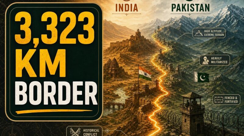
3,323 kilometres. That’s the length of the border between India and Pakistan — a number that means almost nothing until you learn how it was created. Two nations were born on 14 August and 15 August 1947. Their shared border was already drawn by 17 August. Seventy-two hours. Communities that had lived side by side for generations woke up to find themselves in different countries, separated by a line that lawyers and administrators had carved into maps under enormous political pressure.
That border has been contested, militarised, and fought over ever since. Here’s what makes it one of the most dangerous international boundaries on Earth.
A Line Drawn in 75 Days
The speed of Partition was staggering — and it left wounds that still haven’t closed.
The border between India and Pakistan was formally established on 17 August 1947, arising from the Partition of India. The demarcation process that produced it took less than 75 days from start to finish. To understand how extraordinary that is, consider that most international borders are negotiated over decades, sometimes centuries, through wars and treaties and slow geographic compromise. This one was drawn by committee, under a colonial deadline, while millions of people were already moving.
To put 3,323 kilometres in perspective: that’s roughly the distance from London to Tehran, or from New York to Denver and back. It crosses mountains, deserts, rivers, and one of the strangest tidal marshlands on the planet. According to PBS, which cites the figure directly, every one of those kilometres has been disputed, defended, or fought over at some point in the decades since.
Borders drawn fast are borders drawn badly. This one proved that rule within months of its creation — and the consequences are still playing out today.
The Two Documents Holding Everything Together
For the first 25 years after Partition, the border’s exact shape remained a source of open conflict. Then came 2 July 1972.
Following a war between the two countries, the Shimla Agreement was ratified — and it gave the border the shape it holds today. The agreement didn’t just redraw lines on a map. It created a framework for how India and Pakistan were supposed to manage their relationship going forward, including the deeply contested region of Kashmir.
The Shimla Agreement built on an earlier document: the Karachi Agreement of 1949. Together, these two treaties form the entire legal foundation of 3,323 kilometres of one of the world’s most militarised frontiers. Two documents, signed 23 years apart, governing a boundary that touches the lives of hundreds of millions of people.
The problem is what those agreements couldn’t resolve — and what they left deliberately ambiguous.
The Line That Isn’t a Border
Kashmir sits at the northern end of the India–Pakistan frontier, and it operates by entirely different rules.
The Line of Control — the de facto boundary dividing Kashmir between the two countries — is not part of the internationally recognised border. It is not fully governed by the same treaties. It carries no permanent legal status under international law. It is, in the bluntest terms, a ceasefire line that both sides have been treating as a border for decades, while neither side formally accepts it as one.
That ambiguity is not a technicality. It is the reason this region has seen repeated military standoffs, cross-border skirmishes, and geopolitical crises that have pulled the attention of the entire world. Two nuclear-armed nations share a boundary that, in its most critical section, neither side officially recognises as permanent.
The Line of Control runs through some of the highest and most unforgiving terrain on Earth. Soldiers on both sides have been stationed at altitudes where the cold alone is a lethal threat. The geography makes the dispute harder, not easier, to resolve — and it ensures that any escalation in Kashmir carries consequences far beyond the mountains themselves.
The Only Door Between Two Countries
For most of the border’s length, there is no crossing. No road, no bridge, no checkpoint. Just fencing, military posts, and the occasional floodlit no-man’s-land.
For years, there was exactly one operational and legal land crossing between India and Pakistan: the Attari-Wagah crossing, connecting the Indian city of Amritsar to the Pakistani city of Lahore. It became famous for its daily flag-lowering ceremony — a theatrical display of military precision that drew thousands of tourists from both sides and from around the world. Two armies, facing each other across a gate, performing a ritual of rivalry that somehow felt almost like a shared tradition.
Then India closed it. Following a militant attack on tourists, the Attari-Wagah crossing was shut down. The two countries were left with no operational legal land crossing at all — two nations sharing 3,323 kilometres of border and, as of the most recent reporting, zero legal ways to walk between them.
That closure is a precise measure of how fragile the relationship along this border actually is. The one door that existed — the one symbolic point of contact — was shut.
Where the Border Disappears Into the Sea
At its southern end, the India–Pakistan border doesn’t end at a fence or a wall. It dissolves into water.
Sir Creek is a tidal estuary sitting in the Rann of Kutch — the vast salt marsh spanning the Indian state of Gujarat and the Pakistani province of Sindh. It is one of the strangest geographic endpoints of any international border on Earth. The land itself shifts with the seasons: during monsoon, parts of the Rann flood completely; during dry season, they become white salt flats stretching to the horizon.
The exact line through Sir Creek has itself been disputed. When the land moves and the water rises, the border moves too — at least in theory. It is a fitting end to a boundary that has never been entirely fixed.
Final Thought
From the frozen ridgelines of the Line of Control to the tidal mudflats of Sir Creek, the India–Pakistan border is defined by one consistent quality: instability. It was drawn too fast, governed by too few documents, and left too many critical questions unanswered. Nearly eight decades later, those unanswered questions still shape the security of an entire region. The 3,323-kilometre number is striking. What it represents — a boundary that has never truly been settled — is more striking still.
Frequently Asked Questions
How long is the India-Pakistan border?
The India-Pakistan border stretches 3,323 kilometres, crossing mountains, deserts, rivers, and marshlands. To put it in perspective, that distance is roughly equivalent to travelling from London to Tehran.
When was the India-Pakistan border created?
The India-Pakistan border was formally established on 17 August 1947, just two days after both nations gained independence. The entire demarcation process took less than 75 days from start to finish.
Why is the India-Pakistan border considered dangerous?
The border was hastily drawn in under 75 days under colonial pressure, separating communities that had lived together for generations. It has been contested, militarised, and fought over ever since its creation in 1947.
Recommended Reading
Explore these hand-picked resources to dive deeper into this topic:
- The Shadow of the Swastika: The Rise of Fascism and the Fall of the League of Nations by Kiran Desai
- Midnight’s Furies: The Deadly Legacy of India’s Partition by Ramachandra Guha
- National Geographic: India Pakistan Border Documentary Series (geopolitical conflict analysis)
As an Amazon Associate, we earn from qualifying purchases. This helps support Fact Storm Hub at no extra cost to you.
Sources
- https://en.wikipedia.org/wiki/India%E2%80%93Pakistan_border
- https://www.youtube.com/watch?v=YoRV846Zflk
- https://timesofindia.indiatimes.com/city/jaipur/250-year-old-shrine-near-india-pakistan-border-faces-notice-amid-anti-encroachment-drive/amp_articleshow/131887845.cms
- https://www.dawn.com/news/amp/1919573
- https://www.france24.com/en/live-news/20250425-pakistan-and-india-border-closure-separates-families
🤖 AI Content Disclosure
This article was created using AI-assisted research and writing tools, then reviewed for quality and accuracy. Facts are sourced from publicly available web research, but readers should verify critical information from primary sources.
Published for educational and entertainment purposes. Last reviewed: August 2026