
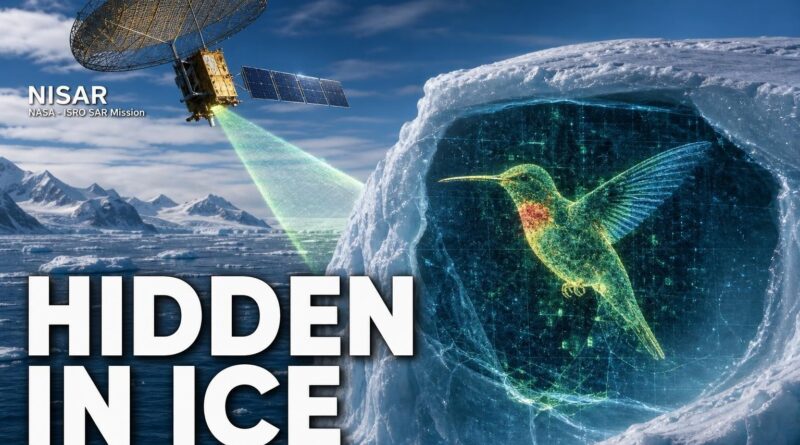
NISAR’s Antarctica Discovery: Hidden Hummingbird in Ice
NISAR’s Antarctica Discovery: Hidden Hummingbird in Ice
You’re looking at one of the most remote corners of the planet — a frozen wasteland where no human drew a single line — and there it is. A hummingbird. Wings spread, beak pointed outward, etched into the Antarctic ice by nothing but physics.
This isn’t a camera trick. Nobody edited it in. A radar satellite in orbit fired microwave pulses toward Earth, waited for the signals to bounce back, and the ice assembled itself into a bird. Once you see it, you cannot unsee it.
This is the story of NISAR, the satellite that captured it, and what that image is quietly telling scientists about a continent that affects every coastline on Earth.
The Satellite That Doesn’t Need Sunlight
Most Earth-observation satellites work like cameras — they wait for sunlight to reflect off the surface below and capture that reflected light. Clouds block them. Darkness stops them. At any given moment, half the planet is effectively invisible to them.
NISAR works differently, and that difference is everything.
Instead of waiting for sunlight, NISAR generates its own energy. It fires polarised microwave radar waves toward Earth’s surface and analyses how those waves bounce back. Ice, rock, water, and vegetation each return the signal in a distinct way — the satellite reads those differences like a fingerprint. Clouds don’t interfere. Day or night makes no difference. The radar punches straight through both.
Launched on July 30, 2025, from India’s Satish Dhawan Space Centre, NISAR is a joint NASA-ISRO mission. It carries two radar instruments — an L-band and an S-band — giving the satellite a surface sensitivity that neither agency had achieved alone.
The operational result: NISAR monitors nearly all of the planet’s land- and ice-covered surfaces twice every 12 days — not once a season, not once a month, but on a precise, repeating cycle, whether the target is the Sahara or the deep interior of Antarctica.
What the Ice Actually Did
Nunatak Zaterjavshijsja. The name is a mouthful, but the geography is simple: it’s a rocky mountaintop in East Antarctica jutting up through the surrounding ice sheet. A nunatak, in plain terms, is a peak of exposed rock completely surrounded by glacier — an island of stone in a frozen sea.
Here’s where the physics becomes remarkable.
The glacier around this nunatak isn’t stationary. It’s flowing northeast toward the ocean — slowly, relentlessly, under its own immense weight. When that moving mass of ice meets the mountain, it cannot pass through. So it splits, bends, and reorganises around the obstacle. That process fractures the ice into deep cracks called crevasses.
The mountain acts like a stone dropped into slow-motion water. The ice curves around it, and the fracture lines follow those curves. From the ground, you’d see jagged cracks spreading outward in all directions. From space, through NISAR’s L-band radar eye, the picture resolves into something instantly recognisable.
A hummingbird — wings spread, beak pointing outward — formed entirely by the geometry of a mountain and the movement of ice. NISAR scientists have unofficially nicknamed it exactly that: “the hummingbird.” The name has already stuck.
Reading the Colors in the Image
The hummingbird isn’t just visually striking — it’s scientifically legible, and every color in the image means something specific.
In NISAR’s L-band radar image, crevasses appear as sharp green lines. Fractured, chaotic ice scatters the returning radar signal in a way that registers distinctly from everything around it. The smoother, more regular ice surfaces — undisturbed by the mountain’s influence — appear in magenta.
The contrast between those two textures, green fracture lines against magenta smooth ice, is what draws the bird shape. The beak, the wings, the body — each element corresponds to a real physical feature of the glacier. The image isn’t decorative. It’s a map of stress, movement, and fracture, rendered in radar frequencies that the human eye has been given a color key to read.
When data from both of NISAR’s radar instruments — the L-band and S-band — became publicly available on July 20, 2026, researchers and scientists worldwide gained access to this full picture for the first time. The hummingbird image was among the first results to draw widespread attention, a vivid demonstration of what the satellite’s dual-instrument design could reveal.
Why Scientists Are Paying Close Attention
The hummingbird is striking. But the scientific weight behind it goes well beyond visual novelty.
Crevasses are among the clearest indicators of stress in a glacier. When ice is stable and moving at a steady pace, crevasse patterns are relatively predictable. When a glacier accelerates — as many Antarctic glaciers have been doing — the crevasse networks change. New fractures open. Existing ones widen. The geometry of the whole system shifts.
NISAR’s twice-per-12-day monitoring cycle means scientists can compare images taken less than two weeks apart and track exactly how those patterns are evolving. A fracture that didn’t appear in one pass might show up in the next. A smooth magenta surface might begin breaking into green lines within a single imaging cycle.
That matters because crevasse formation is directly connected to how quickly ice breaks apart and reaches the ocean. Ice that fractures more readily calves into icebergs faster. Icebergs that reach the ocean contribute to sea level rise. The chain from a crack in Antarctic ice to coastal flooding is real — and what has historically been missing is consistent, high-resolution monitoring of exactly what’s happening on the ice surface.
NISAR is built to close that gap. The hummingbird image is the satellite doing precisely what it was designed to do: converting raw radar data into something that scientists — and now the public — can see, interpret, and act on.
A Final Thought
A hummingbird appeared in Antarctica because a mountain got in the way of a glacier. No artist, no algorithm, no intention — just physics doing what physics does, and a radar satellite sharp enough to catch it.
That image is beautiful. It is also a warning label on a continent that holds enough ice to raise global sea levels by roughly 58 metres if it melted entirely. NISAR won’t stop that process. But it will watch it — every 12 days, through cloud and darkness, without blinking — and give scientists the consistent, high-resolution record they need to understand how fast it’s actually happening.
The hummingbird is frozen in ice. The data it represents is anything but.
Frequently Asked Questions
What is the NISAR satellite and who launched it?
NISAR is a joint NASA-ISRO satellite launched on July 30, 2025, from India’s Satish Dhawan Space Centre. It carries two radar instruments, an L-band and an S-band, to monitor Earth’s land and ice-covered surfaces.
How does the NISAR satellite take images through clouds and darkness?
NISAR fires polarised microwave radar waves at Earth’s surface and analyses how they bounce back, meaning clouds and darkness do not interfere. This allows it to image any location on Earth regardless of weather or time of day.
What did NISAR photograph in Antarctica?
NISAR captured a radar image of Antarctica that naturally revealed a hummingbird shape hidden in the ice. The shape was not edited or artificially created — it emerged purely from how radar signals reflected off the ice surface.
Recommended Reading
Explore these hand-picked resources to dive deeper into this topic:
- The Elegant Universe by Brian Greene
- Astrophysics for People in a Hurry by Neil deGrasse Tyson
- National Geographic Globe (illuminated rotating)
As an Amazon Associate, we earn from qualifying purchases. This helps support Fact Storm Hub at no extra cost to you.
Sources
- https://www.jpl.nasa.gov/news/us-india-satellite-delivers-data-reveals-hummingbird-in-antarctica/
- https://www.indiatoday.in/amp/science/story/nasa-isro-nisar-satellite-captures-hummingbird-shaped-ice-formation-in-antarctica-2953392-2026-07-22
- https://www.moneycontrol.com/science/nasa-isro-s-nisar-spots-a-hummingbird-in-antarctica-but-it-s-not-what-you-think-article-13980333.html/amp
- https://www.businesstoday.in/amp/science/story/bt-explainer-why-nisars-hummingbird-image-from-antarctica-is-more-than-just-a-stunning-space-photograph-544519-2026-07-22
- https://science.nasa.gov/photojournal/nisars-l-band-radar-reveals-hummingbird-in-antarctica/
🤖 AI Content Disclosure
This article was created using AI-assisted research and writing tools, then reviewed for quality and accuracy. Facts are sourced from publicly available web research, but readers should verify critical information from primary sources.
Published for educational and entertainment purposes. Last reviewed: July 2026