
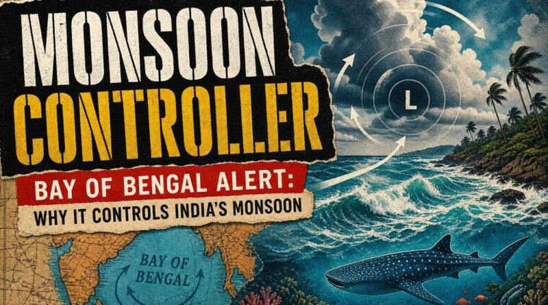
Bay of Bengal Alert: Why It Controls India’s Monsoon
Bay of Bengal Alert: Why It Controls India’s Monsoon
As of this week, Kerala is bracing for heavy rain, lightning, and winds gusting up to 55 kmph along its coast. Fishermen have been told to stay ashore. twelve states are under simultaneous weather alerts. And the trigger for all of it sits quietly in the southwest corner of the Bay of Bengal — a low-pressure area that most people couldn’t point to on a map, but that shapes the lives of hundreds of millions every monsoon season.
What Is a Low-Pressure Area — and Why Should You Care?
The atmosphere over the ocean is never still. Warm seawater heats the air above it, causing that air to rise. When it rises, it leaves behind a zone of lower pressure at the surface. Surrounding air rushes in to fill the gap — and when enough of this happens over a wide stretch of ocean, you get what meteorologists call a low-pressure area.
Think of it like a slow drain in a bathtub. Water (or in this case, air and moisture) spirals inward toward the low point. The bigger the drain, the stronger the pull.
The Bay of Bengal is one of the warmest seas on Earth, which makes it one of the most active generators of these systems. When one forms in the southwest corner — as it has right now — it doesn’t stay local. The India Meteorological Department (IMD) has confirmed that this single system, combined with multiple cyclonic circulations, is currently influencing weather across at least 12 states simultaneously. One patch of ocean. Twelve states. That’s the scale of what the Bay of Bengal can do.
What Kerala Is Actually Facing Right Now
The IMD has forecast 7 to 11 centimetres of rain at isolated places across Kerala within a 24-hour window. To put that in perspective, that’s roughly the amount some cities see in an entire month during dry season — arriving in a single day.
But rain isn’t the only concern. Thunderstorms with lightning and gusty winds of 40 to 50 kmph are expected across Kerala and Lakshadweep. Coastal and adjoining sea regions could see gusts reaching 55 kmph — strong enough to overturn small fishing boats. This is why authorities have advised fishermen not to venture into the Kerala coast, the Lakshadweep area, the Gulf of Mannar, and surrounding sea regions.
Here’s the detail that makes this warning more urgent than it sounds: Kerala recorded a 22 per cent rainfall deficit since March 1 of this year. Two districts — Kollam and Palakkad — have reported the highest shortages. Kozhikode is the only district that has seen excess rainfall during the same period. So when a heavy rain event finally arrives, the ground in many parts of Kerala is dry, cracked, and unprepared to absorb a sudden surge. That combination — parched land plus intense rainfall in a short window — is exactly what triggers flash flooding and landslides.
The Bigger Story: Why the Bay of Bengal Runs India’s Monsoon
Most people think of the monsoon as something that arrives from the Arabian Sea. And it does — that’s the branch that hits Kerala first and moves up the west coast. But the Bay of Bengal branch is the one that waters most of the Indian subcontinent.
The Bay of Bengal sits to the east of India, stretching from the tip of Sri Lanka all the way up to West Bengal and Bangladesh. It is semi-enclosed, meaning it traps heat more effectively than an open ocean. That warmth fuels moisture-laden winds that sweep across eastern and central India every June through September.
Low-pressure systems that form in the Bay — like the one active right now — act as pumps. They pull moisture off the ocean surface and drive it inland. The stronger the system, the deeper the rain penetrates. Some of India’s most intense monsoon spells, and some of its worst floods, have been triggered by Bay of Bengal low-pressure systems that deepened into depressions or cyclones.
This is why a weather alert that originates over a patch of ocean hundreds of kilometres from the nearest coastline can simultaneously affect 12 states. The Bay of Bengal doesn’t just influence Indian weather — in many ways, it is Indian weather.
The Wildlife and Marine Life That Lives Inside This System
While weather alerts focus on human safety, the Bay of Bengal is also one of the richest marine ecosystems on the planet. The same warm, nutrient-rich waters that generate low-pressure systems also support an extraordinary range of ocean wildlife.
The Bay is home to Irrawaddy dolphins, Olive Ridley sea turtles, whale sharks, and dugongs — a marine mammal related to the manatee. The Sundarbans delta, where the Bay meets the land, is one of the largest mangrove forests in the world and the last stronghold of the Bengal tiger in a coastal habitat.
When storms churn the Bay’s surface, they mix deep, cold, nutrient-rich water upward — a process called upwelling. This feeds phytoplankton blooms that form the base of the food chain. In that sense, the same low-pressure system putting fishermen on alert is also, quietly, feeding the fish those fishermen will catch next week.
The warning to stay off the coast isn’t just about human safety. It’s a reminder that the ocean is alive, active, and operating on its own schedule — one that humans have learned, over centuries, to read and respect.
Final Thought
Kerala’s 22 per cent rainfall deficit since March tells one story. The 12-state weather alert triggered by a single Bay of Bengal low-pressure system tells another. Together, they show exactly why this ocean matters far beyond its coastline — it is the engine behind India’s water supply, its agriculture, and the marine ecosystems that millions depend on. The next time monsoon rain hammers a window or a fisherman checks the forecast before dawn, the source is almost always the same: a warm, restless patch of water in the Bay of Bengal, doing what it has always done.
Frequently Asked Questions
What is a low-pressure area in the Bay of Bengal?
A low-pressure area forms when warm seawater heats the air above it, causing it to rise and leave a zone of lower pressure at the surface, drawing in surrounding air and moisture and triggering heavy rainfall across multiple states.
Why does the Bay of Bengal affect monsoon rain in India?
The Bay of Bengal is one of the warmest seas on Earth, making it highly active in generating low-pressure systems that can simultaneously influence weather across at least 12 Indian states during monsoon season.
How much rainfall is Kerala expected to receive during the current weather alert?
The IMD has forecast 7 to 11 centimetres of rain at isolated places across Kerala within a 24-hour window, along with thunderstorms, lightning, and gusty winds of 40 to 55 kmph along the coast.
Recommended Reading
Explore these hand-picked resources to dive deeper into this topic:
- The Monsoon: The Indian Ocean and the Future of American Power by Robert D. Kaplan
- India’s Weather and You by Harsh K. Pant
- National Geographic Atlas of World Geography (reference book)
As an Amazon Associate, we earn from qualifying purchases. This helps support Fact Storm Hub at no extra cost to you.
Sources
- https://keralakaumudi.com/en/kerala/general/heavy-rain-likely-to-continue-across-kerala-low-pressure-likely-over-bay-of-bengal-1744444
- https://tmv.in/article/imd-forecasts-heavy-rain-in-kerala-as-low-pressure-system-intensifies-over-bay-of-bengal-date=2026-05-11
- https://www.cnbctv18.com/india/environment/imd-alert-across-states-due-to-low-pressure-area-in-bay-of-bengal-heavy-rains-in-kerala-tamil-nadu-ws-l-19855468.htm
- https://www.cnbctv18.com/india/environment/low-pressure-area-over-bay-of-bengal-to-intensify-rains-to-lash-tamil-nadu-kerala-ws-l-19853330.htm

🤖 AI Content Disclosure
This article was created using AI-assisted research and writing tools, then reviewed for quality and accuracy. Facts are sourced from publicly available web research, but readers should verify critical information from primary sources.
Published for educational and entertainment purposes. Last reviewed: July 2026